

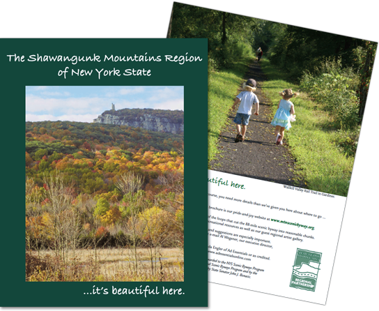
We live in a region of mountains, forests, farms, rivers and streams, small hamlets and rolling, still unspoiled countryside, alive with nature and, yes, it is beautiful here.
Pronounced SHON-gum by locals, the region is outlined by the Shawangunk Mountains Scenic Byway, officially designated a New York State Scenic Byway by the state legislature and the governor in the fall of 2006. An alternate route through Gardiner was added in the fall of 2009.
The now 88-mile byway encircles the northern Shawangunk Mountains and travels through the Rondout and Wallkill valleys, linking communities that have a common relationship to the northern Shawangunks and forming a distinct region of the state with its own special character.
The state awarded designation based on the significance of the scenic, natural, historic and recreational resources in the region.
During the six years of planning the byway, our nine towns and two villages came to realize that we have a lot in common and that much can be achieved by working together. So we created an intermunicipal partnership to implement our corridor management plan, to help improve our transportation systems, and to advance our mutual goal of gaining economic growth through tourism while helping to preserve the important resources of our region.
The Shawangunk Mountains Regional Partnership of the towns of Crawford, Gardiner, Marbletown, Montgomery, New Paltz, Rochester, Rosendale, Shawangunk, Wawarsing and the villages of Ellenville and New Paltz is the management organization for the Shawangunk Mountain Scenic Byway.
Our Magazine is a great introduction to the region and the Byway. Have a look:
View/Print/Download the Magazine PDF File
(9MB, 13 Pages)