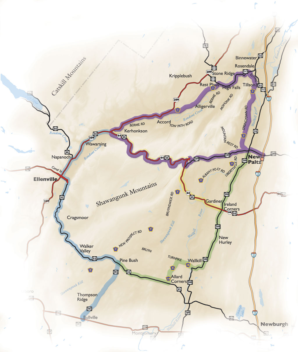
Travel from Route 299 (Main Street) in New Paltz through the village and over the Wallkill River Bridge. Here you can park in the lot and hike or bike the River to Ridge Trail that meanders through fields of corn and hay and opens up onto magnificent views further up the trail. Continue driving straight on Route 299 toward the Shawangunk Mountains; you’ll see them ahead of you.
When the road ends make a right onto Route 44/55, the beginning of a 10.4 mile classic mountain road that follows a notch caused by cross-cutting faults. Pass by the Mohonk Preserve Trapps Gateway Visitors Center on your right.
Continue through the 5 mile per hour hairpin turn and up to the first of three overlooks. The view from this Gardiner overlook is truly breathtaking. Continue past the steel bridge and the parking area and Mohonk’s Trapps entry. The Minnewaska State Park Preserve: Peters Kill area is on the right and a bit further up the mountain pass the entrance to Minnewaska State Park Preserve is on the left. The second and third scenic overlooks offer views of the Catskills, and then the road descends into residential area. Go over the Rondout Creek just before reaching Route 209. Make a right onto Route 209 north.
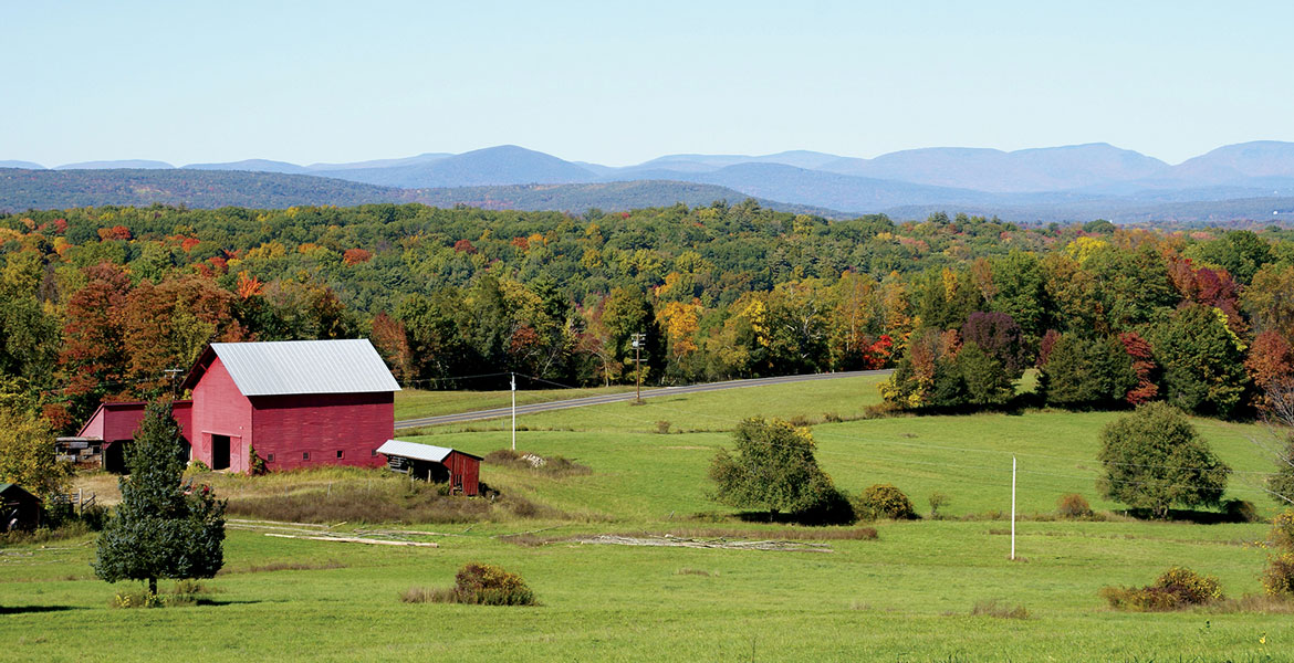
You will drive through Kerhonkson, a community that has an active agricultural foundation. Pass by organic Arrowhead Farm on the right and a bit further down the road Kelder’s Farm, which has pick-your-own, a petting zoo, and a fresh vegetable market. You can’t miss the spectacular views of the mountains that tower behind the farm land. Continue along Route 209 past Saunderskill Farm Market and Nursery and the Catskill Mountain backdrop on your left and then through the hamlet of Accord; Main Street is a short ride off the byway route on the right.
Make a right onto Route 1 (Lucas Turnpike). Roads to Alligerville and Kyserike, areas rich in D&H Canal history are to the right. The Rondout Creek meanders alongside farms and pastures as you continue on Lucas Turnpike. As a sidetrip into the past turn left onto Rest Plaus Road, which will lead to Old King’s Highway, and the Kripplebush historic district, where many original houses still stand. At the light make a right onto Route 213 into the hamlet of High Falls. (Historic Stone Ridge is left at this light and a right onto Route 209). Don’t miss the D&H Canal Museum off Mohonk Road in High Falls. While visiting the museum be sure to go down the street to the Five Locks Walk and hike the one-half mile Towpath. Follow the Rondout Creek on Route 213 past the Snyder Estate Natural Cement Historic District and the old cement town of Rosendale. While here park in the lot and explore the refurbished Trestle Bridge. This is a highlight along the Wallkill Valley Rail Trail and is about 150 feet tall and 900 feet long and offers amazing views of the town and surrounding area. Back on the road, go over the bridge and follow the road as it winds up the hill, past St. Peter’s Church to Route 7 (Springtown Road). (Follow Route 213 a short distance into the small town of Rosendale for a worthwhile detour to an old Canal town.)
Route 7 was the Main route from New Paltz to Kingston in the early 19th century. Pass by DEC’s Fishing Access site to the Wallkill River, and entrance to the Rail Trail and farmland. On the right standing 1,200 feet above sea level is Bonticou Crag. At the stop sign turn left and then another left over the Wallkill River Bridge onto Route 299 and into the village of New Paltz, back where you began this trip. A left over the bridge will take you to Historic Huguenot Street, a national landmark district, where seven houses remain since the late 17th century.